Browse categories
Log in
Sign up
Marmara Sea Free Stock Images
Related searches:
sea beach woman
Safe search
Include:
RF-LL
Public Domain
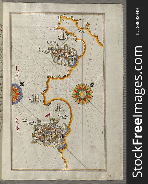
Illuminated Manuscript, Map of the town of Bari and the surrounding area from Book on Navigation, Walters Art Museum Ms. W.658, fo
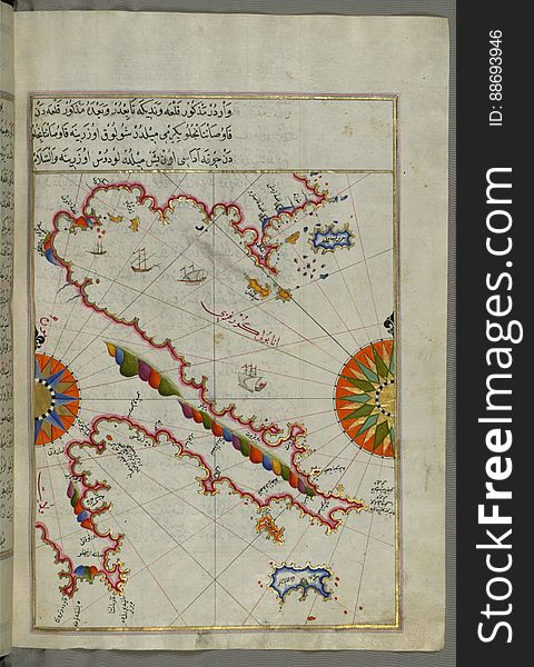
Illuminated Manuscript, Map of the Southern part of the Calabrian peninsula and the straits of Messina (Mesīne) from Bo
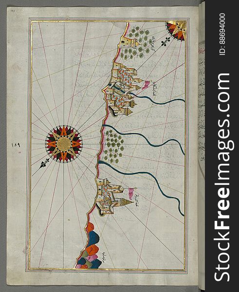
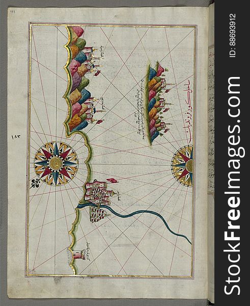
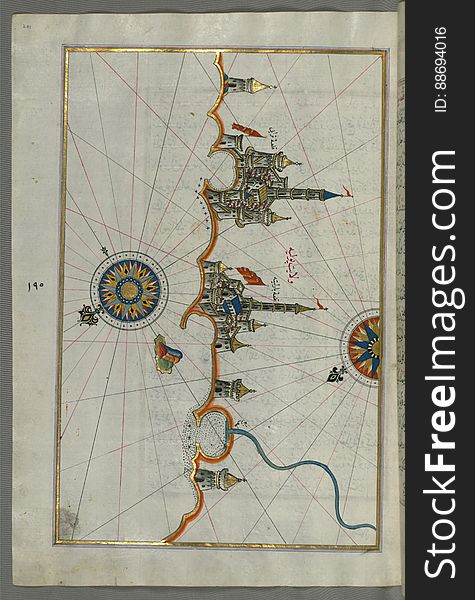
Illuminated Manuscript, Map of the coastline from Mafredonia as far as Barletta on the Italian coast from Book on Navigation, Walt
Lovers Bridge In Winter Night
Illuminated Manuscript, Map of the straits of Messina and the western Italian coast from Book on Navigation, Walters Art Museum Ms
Illuminated Manuscript, The western coast of Greece from the island of Levcas (Lefkada, Leucas, Santa Maura) going north
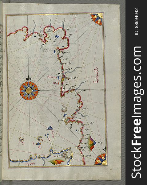
Illuminated Manuscript, Map of the Italian coast between Termoli and Peschici from Book on Navigation, Walters Art Museum Ms. W.65
Illuminated Manuscript, Map of the Italian coastline south of Ancona including Tronto from Book on Navigation, Walters Art Museum
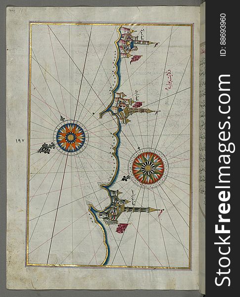
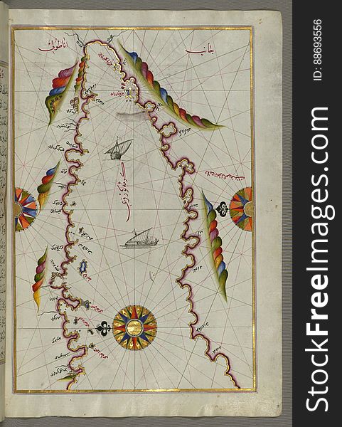
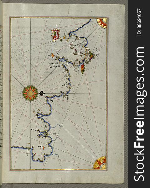
The Anatolian coast along the Kerme Bay from Book on Navigation, Walters Art Museum Ms. W.658, fol. 92a
Illuminated Manuscript Messiniakos Bay (Bay of Messini), fr, om Book on Navigation, Walters Art Museum Ms. W.658, fol.12
Illuminated Manuscript The Methana (Mutūn) fortress in the Saronikos (Aiyina) Bay, from Book on Navigation, W
Illuminated Manuscript, Map of The Bay of Corinth from Book on Navigation, Walters Art Museum Ms. W.658, fol.137a
Illuminated Manuscript, Map of the coastline from Piran (Pirānū) as far as Izola (Īzele) (Slovenia
Illuminated Manuscript, Map of the coastline from Novi Grad as far as Umag (Umago, Ūmāghū) (Croatia) from B
Reflections On Restaurant Window
Illuminated Manuscript Map of the Bay of Salonica (Selānīk,Thessalonici) and the western coastline, from Book on Navig
Lovers Bridge In Soft Evening Sunset
Illuminated Manuscript, Map of the Italian coast south of Ancona as far as the town of Pescara (Beshāre) from Book on N
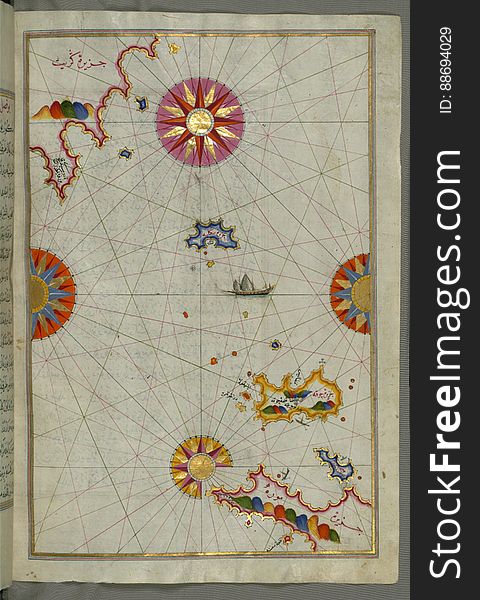
Illuminated Manuscript, Map of Premuda (Premūde Venedīk) island west off the Pag Island (Croatia) from Book
Illuminated Manuscript, Map of the Algerian coast around Algiers (Jazāʾir) from Book on Navigation, Walters Art Museum
Illuminated Manuscript, Map of the Algerian coast around Ora from Melilla (Malīlah) and northwest of Tlemcen (Tili
Lovers Bridge In Winter Night
Illuminated Manuscript, Map of the Italian coastline with the cities of Ravenna (Ruvenne) and Cesena (Sazīne)
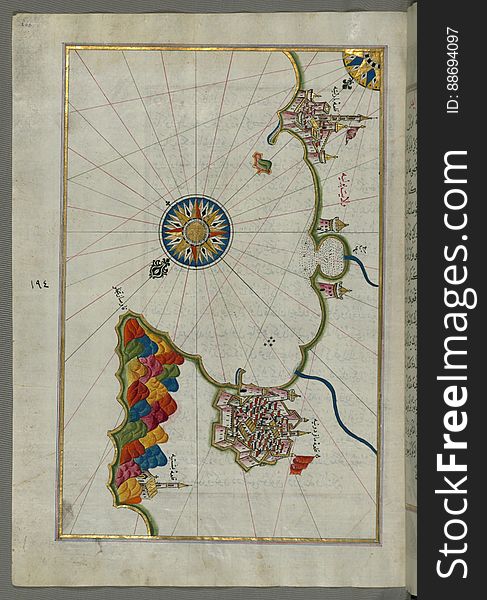
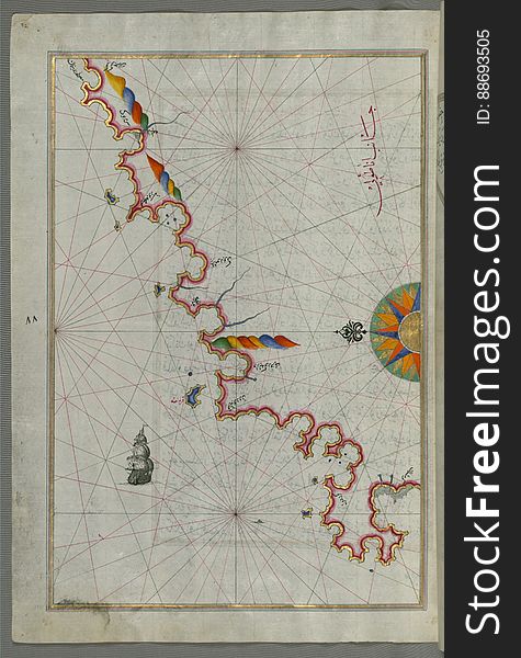
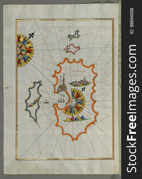
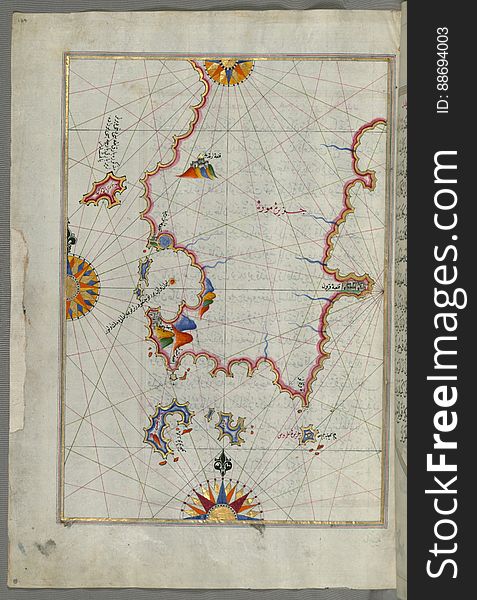
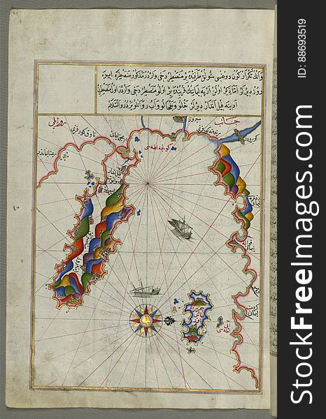
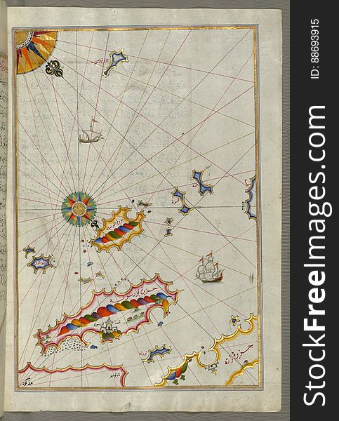
The island of Cos (Stancho, İstanköy) facing the Anatolian mainland from Book on Navigation, Walters Art Museum Ms. W.
Senior Citizen Resting On The Seaside
Illuminated Manuscript, The Islands of Corfu (Kerkira, Kūrfūz) and Paxi (Paxoi) from Book on Navigation, Wal
Illuminated Manuscript, The area between Corfu (Kerkira, Kūrfūz) and Paxi (Paxoi) islands from Book on Navi
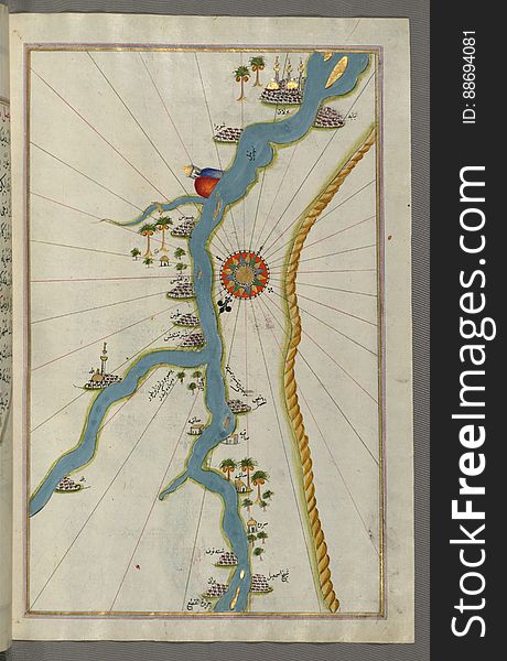
Illuminated Manuscript, Map of towns and oasis along the river Nile beginning with Būlāq (south of Cairo) from Book on
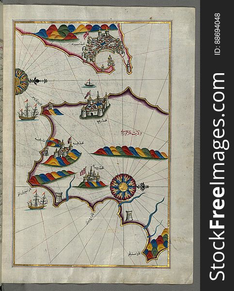
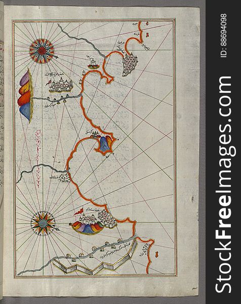
Illuminated Manuscript, Map of the Anatolian coast from Alanya (ʿAlāʾiye Alaiye) to Andalye (Antalya, formerly k
Illuminated Manuscript, Eastern part of the Peloponnese (Morea, Mora) peninsula from Book on Navigation, Walters Art Mu
Anatolian coast and the small Kara (Qarah) island east of the town of Balat from Book on Navigation, Walters Art Museum
Illuminated Manuscript, Map of the coastline from Muggia (Milje, Mūye) to Trieste (Rishtī) (Italy)
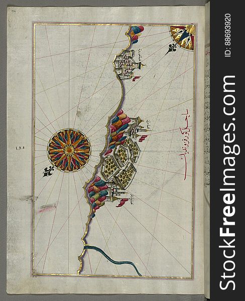
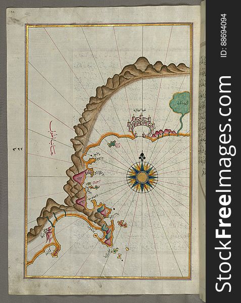
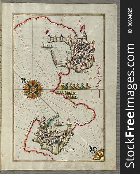
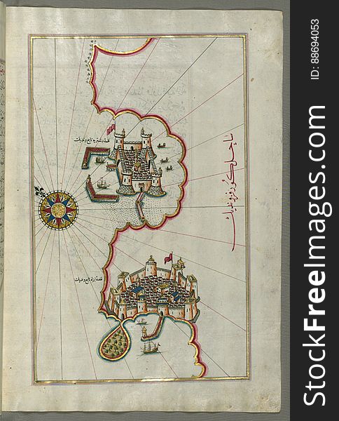
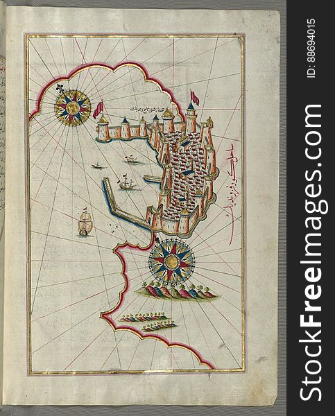
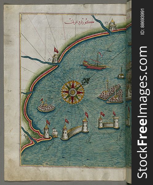
Illuminated Manuscript, Map of the port of Brindisi (Parindīs) from Book on Navigation, Walters Art Museum Ms. W.658, f
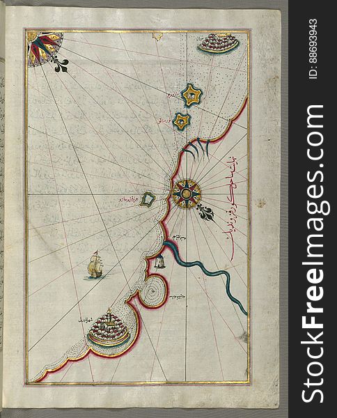
Illuminated Manuscript Map of the area west of the island of Thasos (Taşöz) and the Ayion Oros Peninsula, from Book on
Lovers Bridge In Soft Evening
Illuminated Manuscript, Map of the Dalmatian Islands: Korčula (Qūrsūlah) and Lastovo (Augusta) off the coas
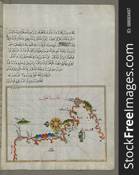
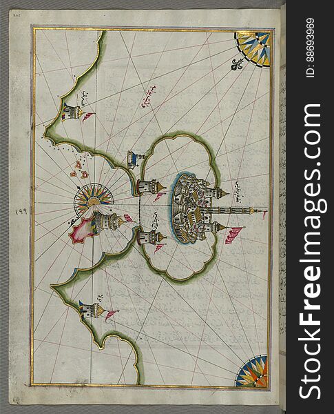
The Bay of Kerme east of east of Cos (Stancho, İstanköy) island from Book on Navigation, Walters Art Museum Ms. W.658
A Summer Town On At Night
Lovers Bridge In Winter Night
Lovers Bridge In Soft Evening
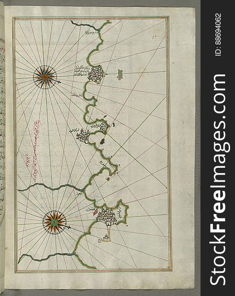
Illuminated Manuscript, Map of the coastline from Izola (Īzele) as far as Koper (Capodistria, Dishtriye) 
Illuminated Manuscript, Map of the coastline from Marano (Mūrān) to Caorle (Qāvarlī), Province of Venice f
Lovers Bridge In Soft Evening
Illuminated Manuscript, Map of the coastline from Poreč (Parenzo, Brānse) as far as Novi Grad (Croatia) from
Lovers Bridge In Soft Evening
Illuminated Manuscript, Map of the Italian coastline from Rimini south towards Pesaro from Book on Navigation, Walters Art Museum
Illuminated Manuscript Argolikos (Anaboli) Bay and Peloponnese (Morea, Mora) peninsula , from Book on Navigat
Lovers Bridge In Soft Evening
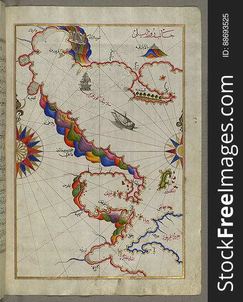
Illuminated Manuscript, Map of the western Italian coast as far as Naples (Pūlye Anāpūlīsī)and the island if Ischia
Lovers Bridge In Winter Night
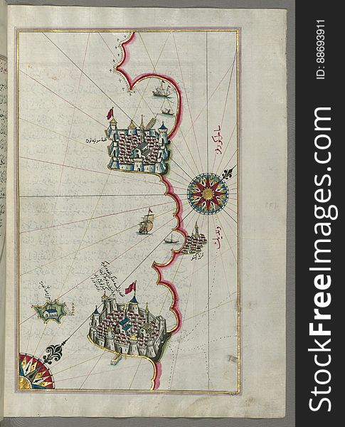
Illuminated Manuscript, Map of the Italian coastline from Barletta to Trani from Book on Navigation, Walters Art Museum Ms. W.658
Strange Rocky Shoreline Sunset
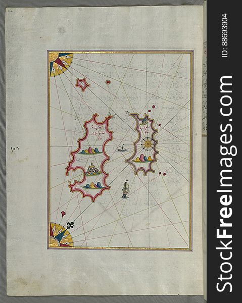
Illuminated Manuscript, Map of two as yet unidentified islands in the vicinity of Pag Island (Croatia) from Book on Nav
Illuminated Manuscript The stretch of water between the Peloponnese (Morea, Mora) peninsula and the Island of Crete wit
Illuminated Manuscript, Book on Navigation, Walters Art Museum Ms. W.658, Illuminated Manuscript of Three hundred and sixty Sufi q
Illuminated Manuscript, Map of the western Italian coast as far as the city of Pisa (Pīze) from Book on Navigation, Wal
Illuminated Manuscript, Map of the fortress of Trieste (Rishtī) (Italy) from Book on Navigation, Walters Art
Illuminated Manuscript, Map of the coast of Andalusia from Valencia (Valense) to Cartagena (Qarte Cine) from B
Illuminated Manuscript, Map of the Italian coastline from Pesaro (Pāzarū) south from Book on Navigation, Walters Art M
Illuminated Manuscript, Map of the western part of the city of Venice (Venedīk) from Book on Navigation, Walters Art Mu
Kids Having Fun On Bumper Cars
Illuminated Manuscript, Map of the coastline and the islands off Zadar (Zādare)(Croatia) from Book on Navigat
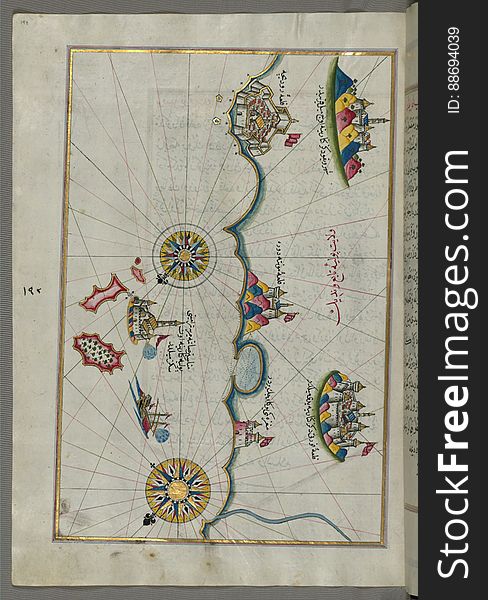
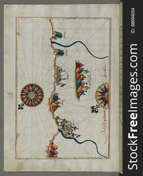
Illuminated Manuscript, The Bay of Salonica (Selānīk, Thessaloniki), from Book on Navigation, Walters Art Museum Ms. W
Next page
3
/ 7
Home
Search for Marmara sea free images