Browse categories
Log in
Sign up
Fol Free Stock Images
Related searches:
pycnanthemum tenuifolium
manifold
water manifold molding
water manifold
construction scaffold
construction jobsite scaffold
folgers
folk dance sweden
increase portfolio
folders
folder
follow light
yellow daffoldils
neatly folded bags
white folding fan
trifold flyer template
tri folder template
neatly folded baskets
followers
folded shirts
leaves
Safe search
Include:
RF-LL
Public Domain
Beginning of winter on an autumnal forest path with colorful fol
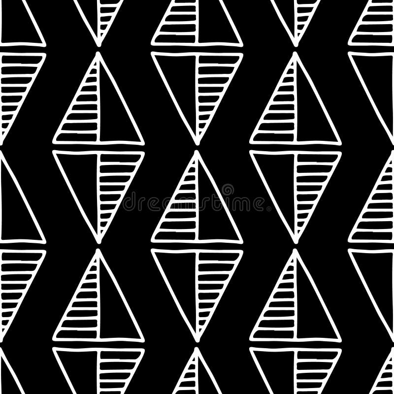
Seamless vector pattern. Black and white geometrical background with hand drawn decorative tribal elements. Print with ethnic, fol
Seamless vector pattern. Black and white geometrical background with hand drawn decorative tribal elements. Print with ethnic, fol
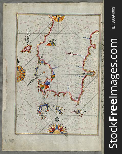
Illuminated Manuscript The island of Syros (Sire) in the Aegean Sea, from Book on Navigation, Walters Art Museum Ms. W.6
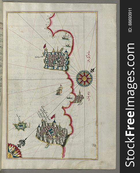
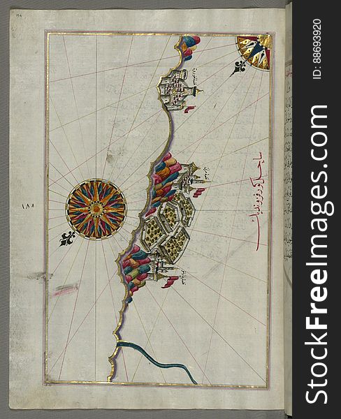
Chios (Sakiz, Sāqiz) Island facing Kysos (Çeşme) fortress on the Anatolian side, from Book on Navigation, W
Illuminated Manuscript, Map of the coastline from Piran (Pirānū) as far as Izola (Īzele) (Slovenia
Illuminated Manuscript, Map of the Italian coast south of Ancona as far as the town of Pescara (Beshāre) from Book on N
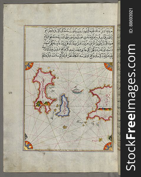
Syme (Sömbeki) island north-west of Rhodes (Rodos) island from Book on Navigation, Walters Art Museum Ms. W.6
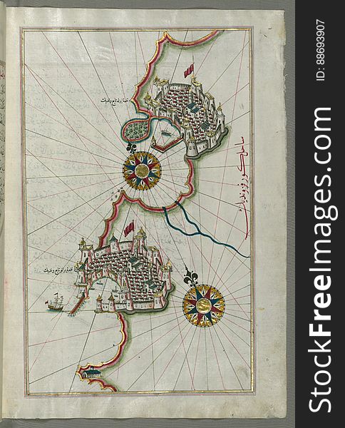
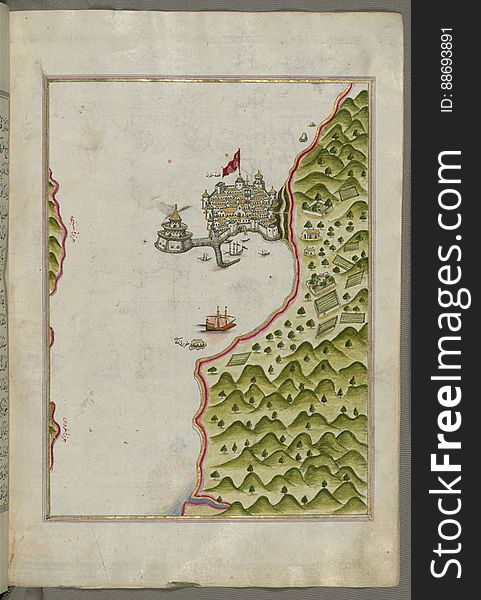
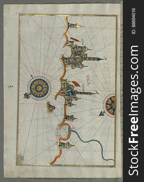
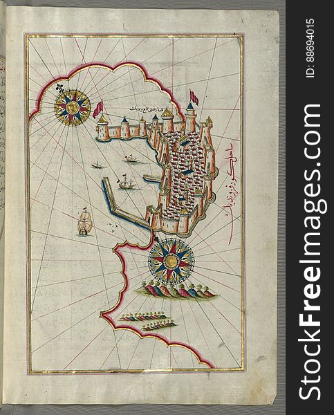
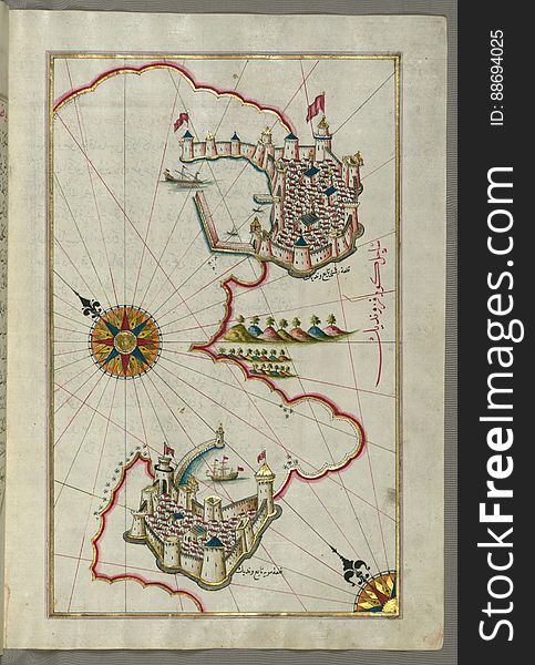
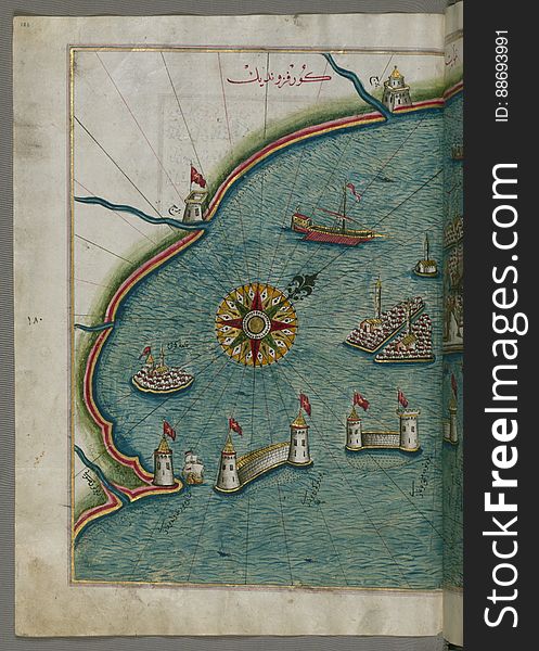
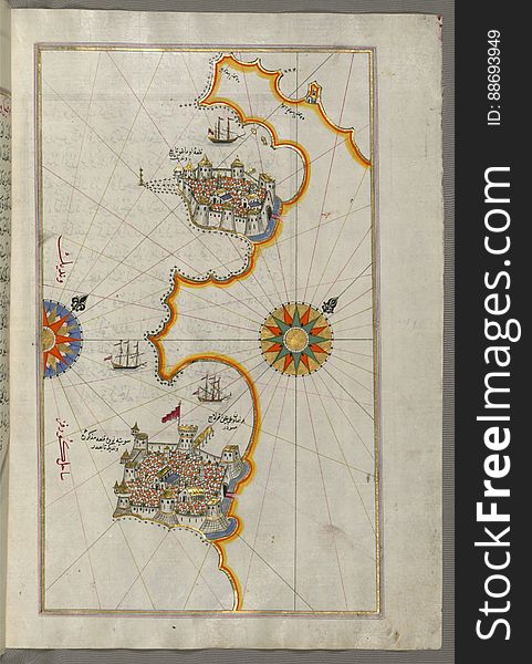
Illuminated Manuscript, Map of the port of Brindisi (Parindīs) from Book on Navigation, Walters Art Museum Ms. W.658, f
Illuminated Manuscript The Methana (Mutūn) fortress in the Saronikos (Aiyina) Bay, from Book on Navigation, W
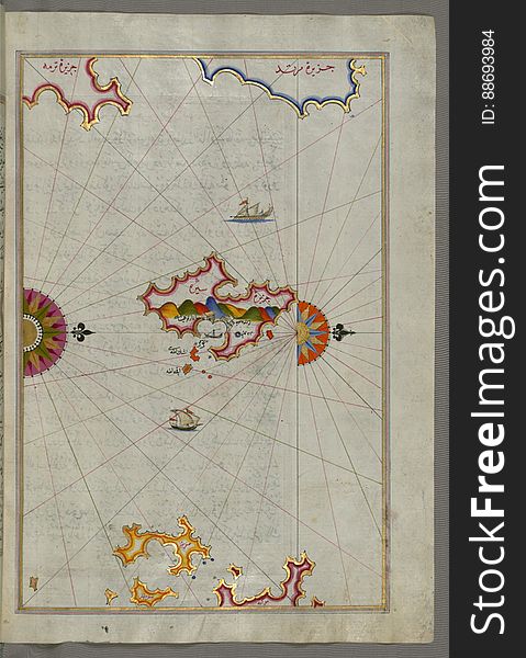
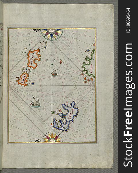
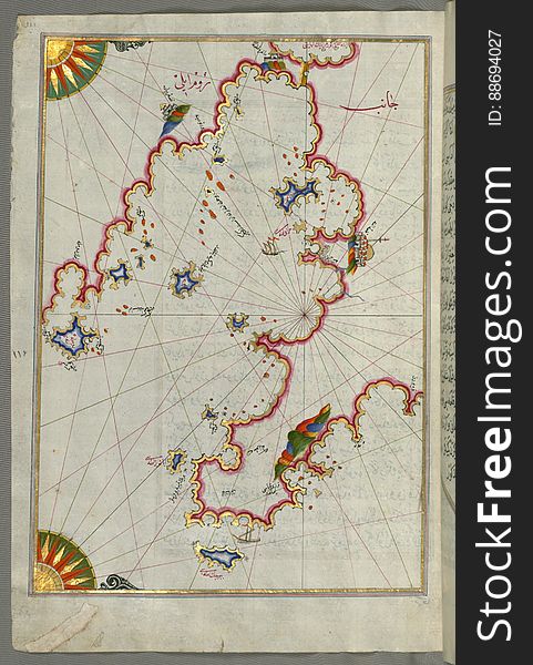
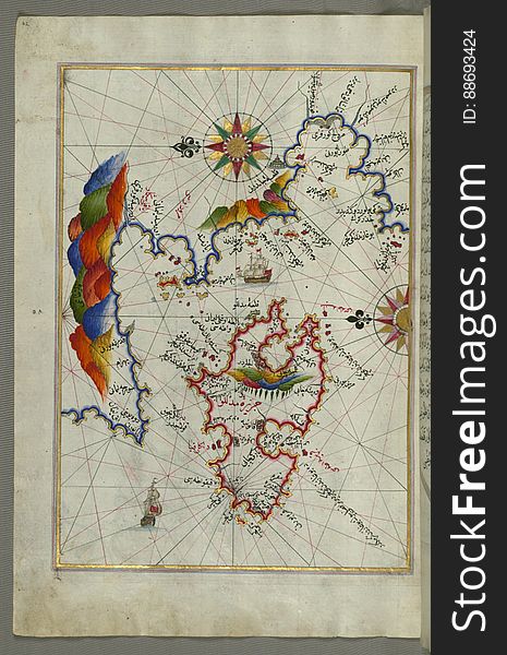
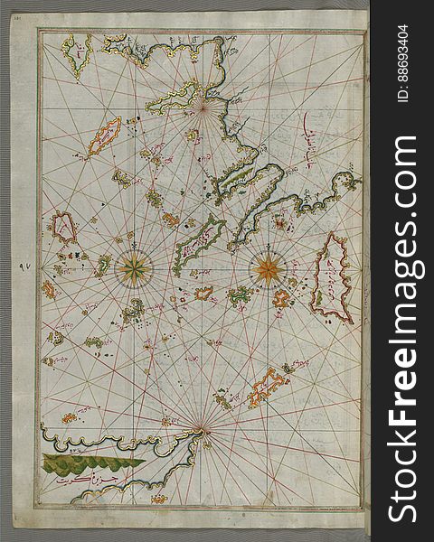
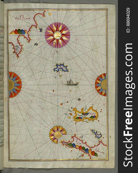
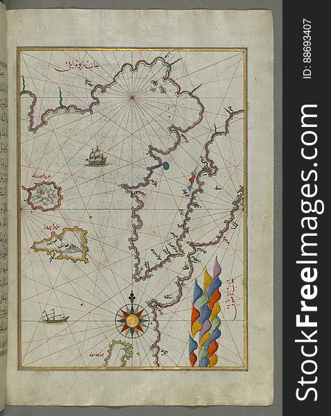
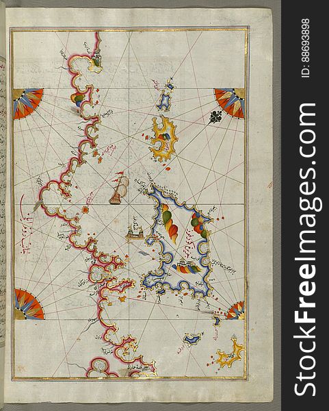
Several islands of the eastern Aegean Sea including: Leros (Līrūs) and Patmos (Bāṭnūz) from Book on Navi
Seamless vector pattern. Black and white geometrical background with hand drawn decorative tribal elements. Print with ethnic, fol
Illuminated Manuscript, Map of the coastline from Poreč (Parenzo, Brānse) as far as Novi Grad (Croatia) from
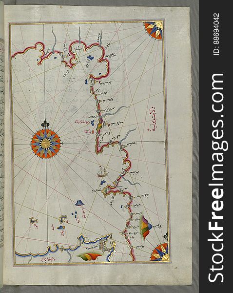
Illuminated Manuscript, The western coast of Greece from the island of Levcas (Lefkada, Leucas, Santa Maura) going north
Illuminated Manuscript The islands of Delos and Rineia west of Mykonos island in the Aegean Sea, from Book on Navigation, Walters
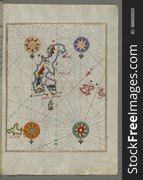
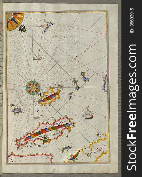
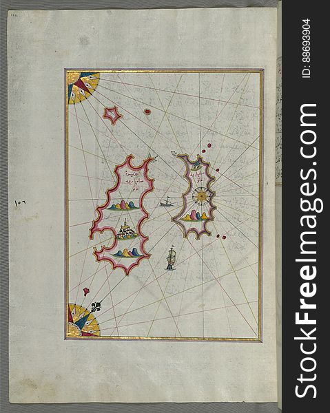
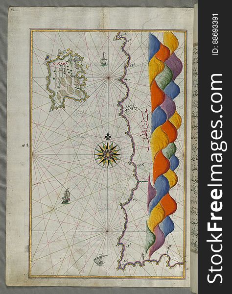
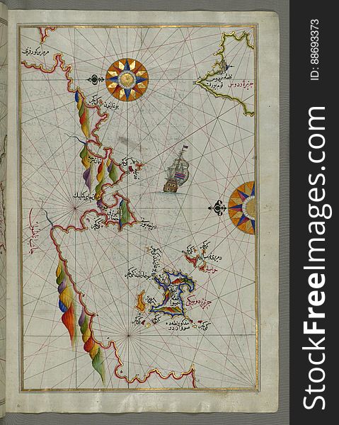
The Island of Kalimnos (Kalimaz) south of Leros in the eastern Aegean Sea from Book on Navigation, Walters Art Museum Ms
Seamless vector pattern. Black and white geometrical background with hand drawn decorative tribal elements. Print with ethnic, fol
Illuminated Manuscript The Island of Amorgos (Yamurgi, Yamorki) in the southeastern Aegean Sea, from Book on Navigation
Illuminated Manuscript The Bay of Saronikos (Atene) with the city of Athens, from Book on Navigation, Walters Art Museu
Illuminated Manuscript Map of the islands of Skyros (İskire) and Euboea (Evvoia, Aghrībūz, Eğriboz), from
Illuminated Manuscript, Map of the Italian coast between Termoli and Peschici from Book on Navigation, Walters Art Museum Ms. W.65
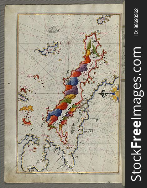
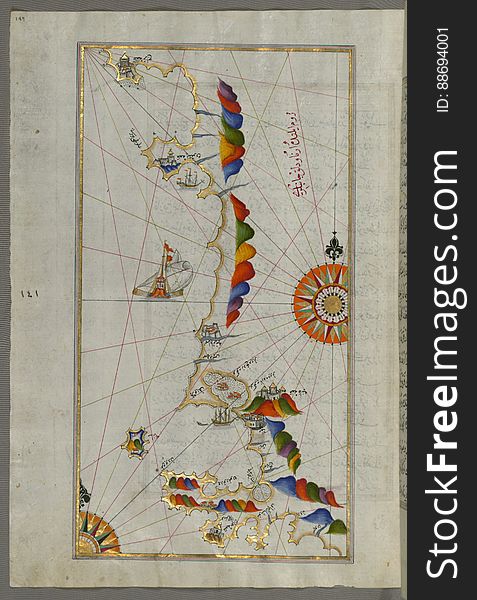
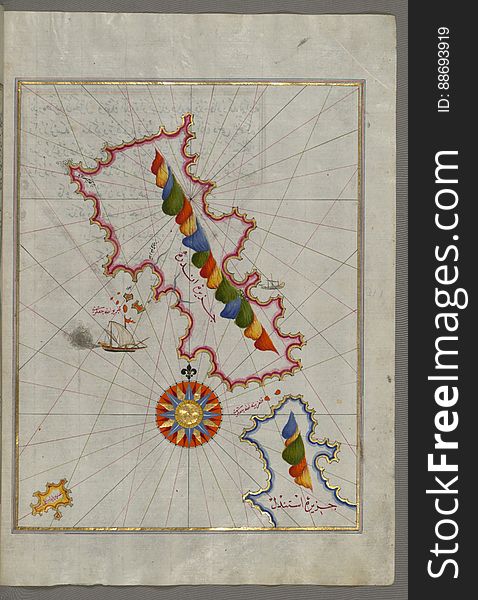
The Island of Midilli (Midillü, Mitylene, Lesvos) in the northeastern Aegean Sea, from Book on Navigation, Walters Art
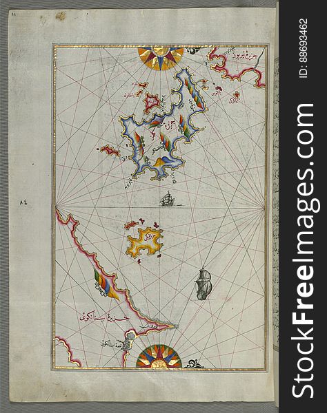
Illuminated Manuscript Map of the area west of the island of Thasos (Taşöz) and the Ayion Oros Peninsula, from Book on
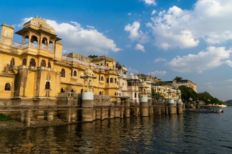
Bagore ki Haveli (Bagore s Palace) Udaipur Rajasthan India
Illuminated Manuscript, Map of the Italian coastline from Barletta to Trani from Book on Navigation, Walters Art Museum Ms. W.658
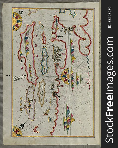
Illuminated Manuscript map of the islands of the Aegean Sea including Chios (Sakiz), Cos (Stancho, İstanköy)
Illuminated Manuscript, Map of the fortress of Trieste (Rishtī) (Italy) from Book on Navigation, Walters Art
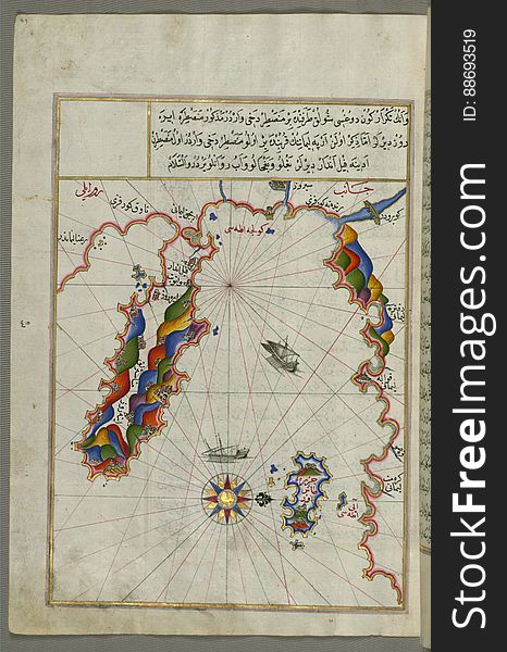
The island of Cos (Stancho, İstanköy) facing the Anatolian mainland from Book on Navigation, Walters Art Museum Ms. W.
Eyes of fire skull
Illuminated Manuscript Tinos (İstendil) island in the Aegean Sea, from Book on Navigation, Walters Art Museum Ms. W.65
Illuminated Manuscript, Map of the Dalmatian Islands: Korčula (Qūrsūlah) and Lastovo (Augusta) off the coas
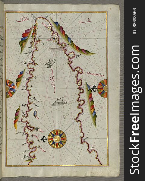
Illuminated Manuscript The stretch of water between the Peloponnese (Morea, Mora) peninsula and the Island of Crete wit
Illuminated Manuscript, Map of the coastline from Marano (Mūrān) to Caorle (Qāvarlī), Province of Venice f
Illuminated Manuscript, The area between Corfu (Kerkira, Kūrfūz) and Paxi (Paxoi) islands from Book on Navi
Illuminated Manuscript, Map of the Italian coastline south of Ancona including Tronto from Book on Navigation, Walters Art Museum
Illuminated Manuscript, The island of Andros (Andre, Andra) in the northern Aegean Sea, from Book on Navigation, Walters
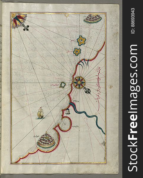
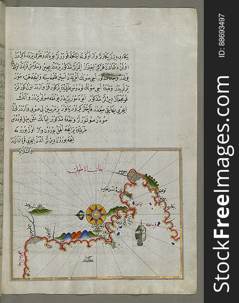
Anatolian coast and the small Kara (Qarah) island east of the town of Balat from Book on Navigation, Walters Art Museum
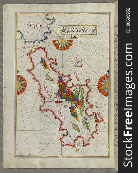
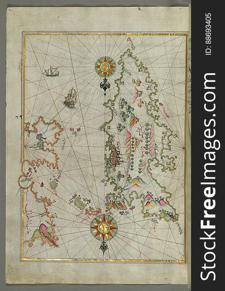
Detailed map of Chios (Sakiz, Ṣāqiz) Island with its fortress and other topographical features, from Book on Navigati
Close up portrait of attractive young entrepreneur with arms fol
Embroidery stitches imitation fashion neck line pattern with fol
Illuminated Manuscript, Eastern part of the Peloponnese (Morea, Mora) peninsula from Book on Navigation, Walters Art Mu
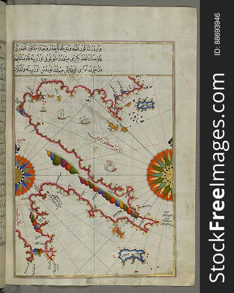
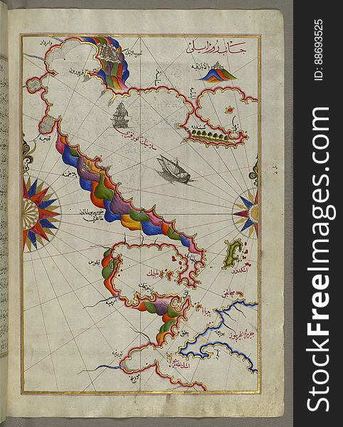
Illuminated Manuscript, Map of the straits of Messina and the western Italian coast from Book on Navigation, Walters Art Museum Ms
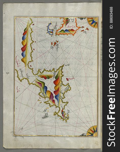
Illuminated Manuscript, Map of two as yet unidentified islands in the vicinity of Pag Island (Croatia) from Book on Nav
Young Business Woman standing against white background with fol
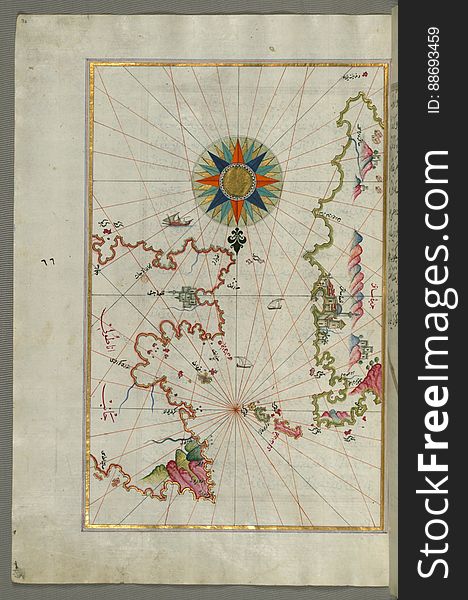
Illuminated Manuscript, Map of the coastline and the islands off Zadar (Zādare)(Croatia) from Book on Navigat
Illuminated Manuscript Map of The Islands of Semendrek (Samothraki) and Imroz (Imbros) in the Aegean Sea, from
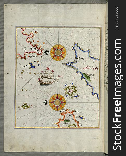
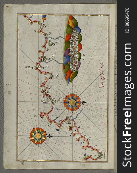
Illuminated Manuscript Map of The island of Bozjah (Tenedos) off the coast of Anatolia, from Book on Navigation, Walters
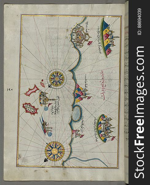
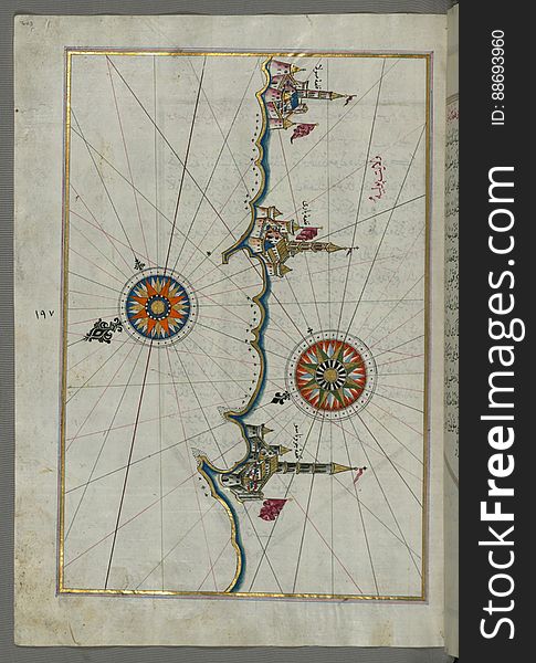
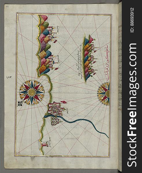
Illuminated Manuscript, Map of the town of Bari and the surrounding area from Book on Navigation, Walters Art Museum Ms. W.658, fo
Illuminated Manuscript Map of the coast of Andalusia with the city of Grenada (Gharnātah), from Book on Navigation, Wal
Illuminated Manuscript, The Islands of Corfu (Kerkira, Kūrfūz) and Paxi (Paxoi) from Book on Navigation, Wal
Illuminated Manuscript map of the northeastern tip of Rhodes (Rodos, Rūdūs) Island facing the Anatolian coast with the
Illuminated Manuscript, Map of the coastline from Muggia (Milje, Mūye) to Trieste (Rishtī) (Italy)
Seamless vector pattern. Black and white geometrical background with hand drawn decorative tribal elements. Print with ethnic, fol
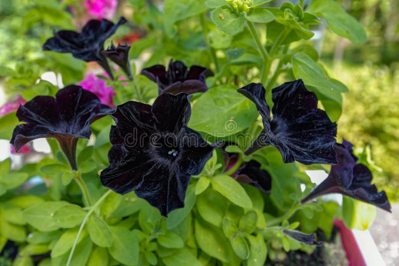
Close-up view to black flower of blooming petunia on natural fol
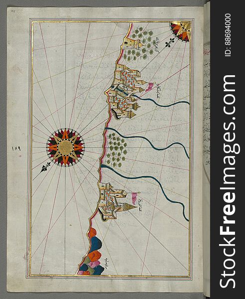
Illuminated Manuscript Argolikos (Anaboli) Bay and Peloponnese (Morea, Mora) peninsula , from Book on Navigat
Illuminated Manuscript Map of the Bay of Salonica (Selānīk,Thessalonici) and the western coastline, from Book on Navig
Telemedicine and Health Records Icon Set with Caduceus, file fol
Illuminated Manuscript, Map of the western part of the city of Venice (Venedīk) from Book on Navigation, Walters Art Mu
Autumnal multicolor grapes leaf (Parthenocissus quinquefolia fol
Illuminated Manuscript, Map of the Italian coastline from Rimini south towards Pesaro from Book on Navigation, Walters Art Museum
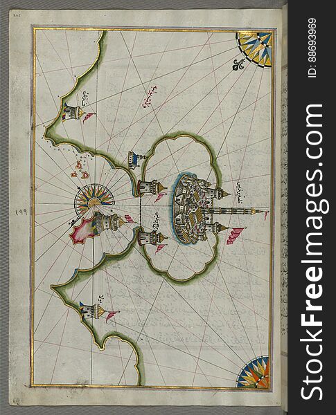
The Bay of Kerme east of east of Cos (Stancho, İstanköy) island from Book on Navigation, Walters Art Museum Ms. W.658
Illuminated Manuscript, Map of the coastline from Novi Grad as far as Umag (Umago, Ūmāghū) (Croatia) from B
Text sign Face Your Fears. Business concept for Challenge Fear Fourage Confidence Brave Bravery written Pin Sticky Note Paper Fol
Next page
2
/ 12
Home
Search for Fol free images