You can use this free image under the Creative Commons Zero (CC0) public domain license. Support our free section by adding a credit line next to the photo in your design. A suggestion is provided under the title.
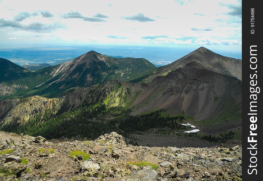
Humphreys Trail No. 51
View of glacial cirque, ridges, and moraine in the Inner Basin of the San Francisco Peaks. View into the interior of the Inner Basin along Humphreys Trail No. 50. The trail starts at the Arizona Snowbowl and winds steeply up to Humphreys Peak, the highest point in Arizona at 12,633 feet. Humphreys Peak is one of several named peaks in the San Francisco Peaks (aka San Francisco Mountain or simply "the Peaks"). The mountain is an extinct stratovolcano. The 5+ mile hike ascends over an elevation gain of over 3,000 feet, and generally take 6 to 8 hours to complete. Brent Johnston of the Coconino National Forest took this photo on a weekend family hike, July 24, 2015. Credit: U.S. Forest Service, Coconino National Forest. For more information about this trail, see the Humphreys Trail No. 51 trail description on the Coconino National Forest website.
© publicdomainstockphotos | Stock Free Images