You can use this free image under the Creative Commons Zero (CC0) public domain license. Support our free section by adding a credit line next to the photo in your design. A suggestion is provided under the title.
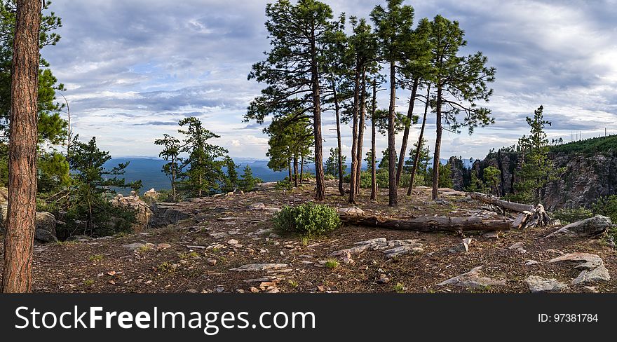
Mogollon Rim
View from the edge of the Mogollon Rim along the Rim Road (FR 300). The Mogollon Rim is one of the most striking geologic features in Arizona. This steep escarpment, measured in thousands of feet and hundreds of miles, begins just across the border in New Mexico and stretches diagonally two thirds of the way across Arizona. It forms the southern edge of the Colorado Plateau, and is one of the most impressive overlooks in the Grand Canyon State. The General Crook Trail/Rim Road Scenic Loop drive is an easy way for the entire family to experience the dramatic scenery of the Mogollon Rim. Photo taken July 20, 2017 by Deborah Lee Soltesz. Source: U.S. Forest Service, Coconino National Forest. Visit Mogollon Rim Ranger District and the Coconino National Forest for more information.
© publicdomainstockphotos | Stock Free Images
Similar Free Images