You can use this free image under the Creative Commons Zero (CC0) public domain license. Support our free section by adding a credit line next to the photo in your design. A suggestion is provided under the title.
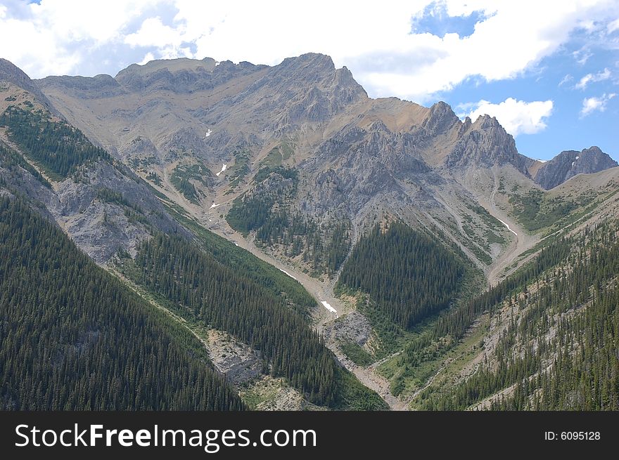
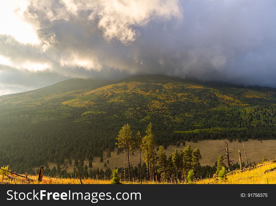
Peaks view from the White Horse Hills, FR 418
The sun rises as the last wisps of a passing storm blanket the San Francisco Peaks. Fall color on the San Francisco Peaks, viewed from the White Horse Hills along Forest Road 418, October 2, 2016. This drive takes you all the way around Arizona's highest mountain, winding through a land of pine forests and aspen groves, open prairies and rustic homesteads. Autumn turns the mountain to gold, filling forest roads and trails with visitors come to enjoy the colorful display. Because the road becomes very rough and rocky between Bear Jaw and Abineau canyons, a mid to high clearance vehicle is required to complete the loop. However, fall color can be seen on either end of the road accessible to low clearance passenger cars. There are a number of places along this route where you can stop to take a hike, enjoy a lunch or even set up a primitive camp. That way you can take more than one day to do this drive or combine it with one or more of the other scenic drives in the vicinity of the San Francisco Peaks. The White Horse Hills are northwest of the Abineau-Bear Jaw Trailhead entrance on the north side of the road. There are no system trails into the hills, but there is an old two-track leading into valley between the hills that is easy to follow on foot. Photo by Deborah Lee Soltesz, October 2, 2016. Source: U.S. Forest Service, Coconino National Forest. See Around the Peaks Loop Scenic Drive for information about this drive on the Coconino National Forest website.
© publicdomainstockphotos | Stock Free Images
Similar Free Images