You can use this free image under the Creative Commons Zero (CC0) public domain license. Support our free section by adding a credit line next to the photo in your design. A suggestion is provided under the title.
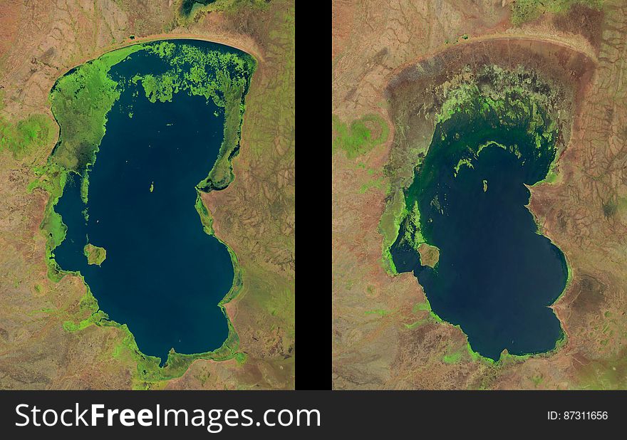
Lake Chilwa, Malawi
Lake Chilwa is a shallow, enclosed saline lake located along the East African Rift Valley in southern Malawi, near its border with Mozambique. This lake experiences high water level fluctuation, as it is strongly influenced by rainfall and summer evaporation patterns. In recent years, Lake Chilwa has been shrinking. Because the basin is an important source of local rice and fish production, the current drying trend is a potential food security concern. These Landsat images show the net reduction of lake area between October 1990 and November 2013. The two images also show changes to the extensive wetlands (bright green) that surround Lake Chilwa. These wetlands are internationally recognized as an important seasonal hosting location for migratory birds from the Northern Hemisphere. Landsat data are extremely useful for scientists and authorities to monitor water resources and land cover changes over time. ‪#‎USGS‬ ‪#‎Landsat‬ ‪#‎satellite‬ ‪#‎lake‬ ‪#‎water‬ ‪#‎climate‬ ‪#‎environment‬ ‪#‎economics‬ ‪#‎food‬ ‪#‎Africa‬ ‪#‎waterloss‬
© publicdomainstockphotos | Stock Free Images