You can use this free image under the Creative Commons Zero (CC0) public domain license. Support our free section by adding a credit line next to the photo in your design. A suggestion is provided under the title.
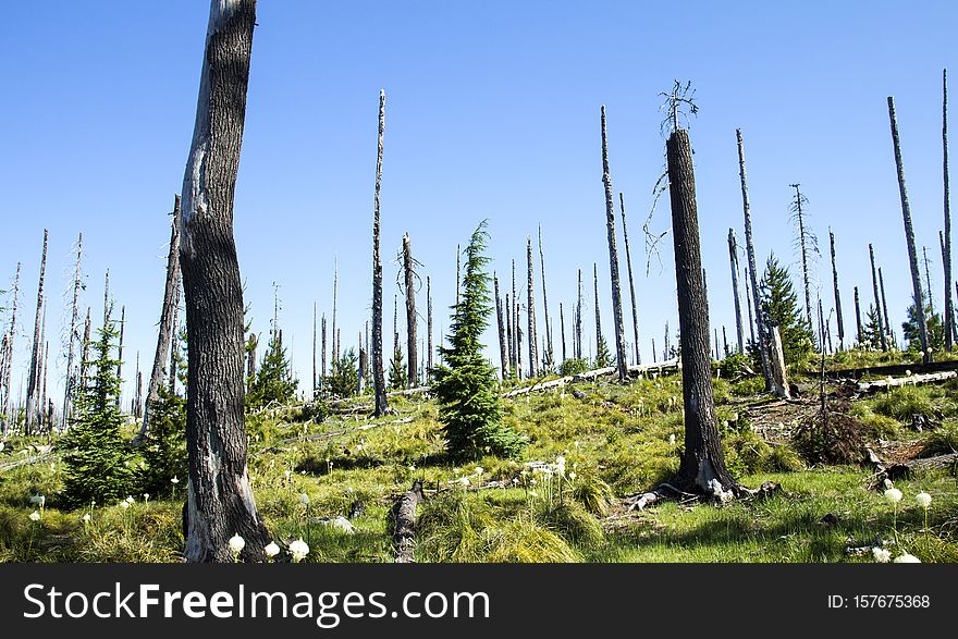
Pacfic Crest Hiking Trail near Hoodoo, Oregon
This section of trail is still recovering from a forest fire in 2003. The white flowers are Bear Grass and are all over this area. The Pacific Crest Trail, officially designated as the Pacific Crest National Scenic Trail (PCT) is a long-distance hiking and equestrian trail closely aligned with the highest portion of the Sierra Nevada and Cascade mountain ranges, which lie 100 to 150 miles (160 to 240 km) east of the U.S. Pacific coast. The trail's southern terminus is on the U.S. border with Mexico, just south of Campo, California, and its northern terminus on the Canada–US border on the edge of Manning Park in British Columbia; its corridor through the U.S. is in the states of California, Oregon, and Washington. The Pacific Crest Trail is 2,653 mi (4,270 km) long and ranges in elevation from just above sea level at the Oregon–Washington border to 13,153 feet (4,009 m) at Forester Pass in the Sierra Nevada. The route passes through 25 national forests and 7 national parks. Its midpoint is near Chester, California (near Mt. Lassen), where the Sierra and Cascade mountain ranges meet.
© publicdomainstockphotos | Stock Free Images
Similar Free Images